
This is part 2 to my "Being a Geography major" blog post and may be a little repetitive to my "What I do for work" Dayre post in some parts but hopefully will also include some new stuff. In this post, I want to focus on the job(s) I've had since graduating that relate specifically to being a Geography major and just some general information about searching for jobs as a Geography major who wants to work in this field.
Jobs for Geography (geotech) majors
When
I was still in school and I would tell people that I was a Geography
major, I was inevitably faced with the question, "What are you going to
do with that?" I know a lot of college students in general tend to get
that question, but I feel like it's especially true for Geography
students because most people are unfamiliar with the major. The most
common second part to that question is "Oh, so, you're going to teach?"
Since most people simply associate geography = memorizing locations,
they figure the only thing you can do is become a teacher. But that's
really not true at all. It's certainly an option and not a bad one, but I
don't think any of the Geography students that I knew (especially in
the geotech focus) were intending to become teachers.
I
can't name all the associated geography jobs here (and let me assure
you, there are many) but one of the easy tracks for students who focused
on GIS is to become a GIS technician and then later a GIS specialist or
analyst (with a few years experience under your belt). This is
essentially someone who works with GIS as the name implies. GIS techs
can work in all sorts of different places and fields - for private
companies or federal, state or local governments, big or small. You can
even work at Google! Google Earth, maps, streetview, traffic etc. all
deal with geography and mapping and constantly need to be updated and
reviewed. A lot of non-profit type groups also tend to need GIS help.
For example, showing the change over time of a wetland area with
aerial imagery to illustrate the need to execute change. These maps can
also be used for planning purposes or to track things such as regulatory
signs that need to be maintained.
Freelance
(or as an employee in a business) cartography is also an option for
many Geography majors. Unfortunately, this didn't end up fully coming to
fruition, but last year I was asked to help/hired to make maps for a
textbook of the Pacific Islands with a friend. There is an existing
book, but the maps in it were not created specifically for it and some
of them I considered quite awful graphically if I'm honest. Although it
didn't pan out, that could have easily been a recurring job if that
publishing company every needed maps done for their books and they were
happy with our work.
For some reason, a common question people seem to have is "Isn't the
world already mapped? Why do we need people who are mappers?". To an
extent, yes, I'm sure the world is already mapped. However, that doesn't
mean there isn't a need for more mapping. Especially when it comes to
updating things and preserving the maps we have from the past and
digitizing them on the computer. Not to mention topic-specific maps. Not
every GIS analyst/technician/cartographer is making a political map of
a piece or part of the world lol. Sometimes you need a map about a very specific topic. How about...idk good dog parks in southern Illinois? idk weird topic and I'm not sure why someone would need that map but I'm sure that map is not readily available on the internet but a GIS tech could probably pretty easily whip one up given the right data! And GIS/mapping definitely comes in handy for planning. Think disaster preparation mapping! Or just a map of a new development. Things like that.
However, small note,
just because your major is XXXX in college, doesn't mean that you
absolutely must get a job in XXXX field in order to be successful. I
know quite a few people who consider themselves to be vocationally
successful who are in a job that isn't even remotely related to their
college major. My college counselor in high school was a Geology major
lol.
Working as a GIS Technician


My first GIS job
As I am writing this, I have only had two GIS jobs so far after graduating. (I don't really count the internship I had during school although technically that was incredibly GIS related as well.) Anyway, my job previous to the most recent one I had was my first GIS job.
I had been working part time as what is essentially an office aid throughout college just to earn money and held on to that job after I graduated. Meanwhile during the last month of school (May), I was constantly on the look out for a job that was related to my major because I definitely wanted to take it if the opportunity arose. My old internship supervisor passed on the word about a job with a few openings, and I called the contact number immediately to find out more information and where to send my resume. In July, I finally heard back that I was being offered a 1-year contract that had the opportunity to be extended. I was a bit nervous to take it because the contract left something to be desired (I highly prefer permanence when I can get it), but I accepted. I didn't exactly know what to expect and actually had a really hard time at this job. Not because I didn't understand GIS, but there was a really difficult coworker who we were forced to work with and nothing could really be done about it.
In any case, here was my desk -

Everyday, I did the same process over and over again but just for different geographical areas on the island. And if I had stayed there, I would probably still be doing the same routine everyday until I died lol. When I started, they told us that there was about a 7 year backlog. I'm not really sure how they measured that, but it was essentially because they had hundreds of linen maps that had been edited/drawn/updated by hand (by a drafting technician) that now needed to be converted to GIS. And some maps will take more time than others, but essentially we were redoing pretty much all of the maps and fixing things that needed to be fixed and updating things that had changed while doing that. It wasn't a difficult task, but I would say that the system wasn't the most effective. Since one map's changes could potentially change 5 more and each of those 5 could effect 5 more etc etc, any changes had to be carefully approved by someone in an entirely different department and building. So a lot of our updates got held up there because she's only one person and there was like 6 of us sending her edits. Besides that, there is research involved in doing the changes so it's not necessarily as simple as just looking at it and saying "oh well, that looks fine". In terms of the GIS side of it, there was already an established workflow set up (by an ESRI contractor) so it was really just a matter of pushing buttons down a line. I would say that I don't really think you necessarily needed to go to school for GIS to understand how to do the job. The hard part was really understanding why you were pushing certain buttons and going through the workflow the way it was intended. I know that's a little vague, but I don't want to get into specifics. Let's just say that it wasn't very analysis-based and was really more about editing polygons and placing annotation so the same kind of map over and over again. There were some that were more challenging due to the research that needed to be done or just their general shapes (because each area is different), but for the most part, there was no design involved and you just needed to follow the guidelines to create these maps that should essentially all look the same. Sorry I don't have very many pictures from this job since I really just sat at my desk all day except when we went to Starbucks or something lol (which is obviously not work related).
Putting aside the workplace politics and considering only the GIS aspect, I think this was a pretty good first "real" GIS job for me. I kind of got my feet wet by essentially doing GIS on my own after a brief introduction and for the most part, I was working independently daily. There wasn't an enormous amount of thinking involved, and it was really kind of like intern work (although people of all ages and work experience backgrounds were doing it). I was fresh out of college anyway, so it seemed really acceptable to me. The benefits were pretty good too. I left because I really felt that I was in a hostile work environment that hindered how effective I could be on the daily. It isn't GIS-related so I'm not going to go into detail since I know it's very specific to that workplace, but I really knew I couldn't stay there long term. I'm really happy I took it and it was certainly a learning experience in more ways than one, but I don't think I'd ever go back.
My most recent GIS job
I applied for this job on a whim while I was still at my first job. I was still getting emails from old professors because I was still on my university's geography department's mailing list. I really wasn't super happy at that job, so whenever I got an email about job opportunities, I would always open it, and if it was a simple process, I would apply without expecting anything much. (Like, if I get it, that's cool and if I don't, well, at least I still have a job. I didn't have all my hopes and dreams pinned to getting a new job.) The email about this job wasn't super detailed but the application process was just to send your resume to a certain email address, so I just decided to do it. A week or so later, someone from the hiring company actually contacted me and told me more about the job. It was kind of "spontaneous" but I ended up actually taking the job because it sounded really promising in terms of growth and what we would be doing (which was to be drastically different from I had been doing for the past year with no chance for advancement).
Like the previous job, most of the time, I worked at a desk in front of a computer. My desk was kind of laid out like this.

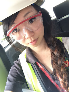
Another part of GIS/Geography that I didn't really hit on earlier is GPS! I mean, this is pretty obviously associated with Geography, identifying where you are on the earth based on feedback from satellites lol. Although most days I sat at a desk, sometimes we needed to do field work! This isn't a part of every single GIS tech's job description (in fact at my first GIS tech job, we never had to leave our desks), but I found a cool part of this job.

 We used a GPS unit (sometimes two) to capture the spatial information using satellites about the topic in question.
For example, if we wanted to make a map of all of the fire hydrants in a facility, we would take the GPS location at each of the fire hydrants we found. I think most people are capable of using a simple GPS these days (and I probably didn't need to get a college degree specifically to use one), but the education comes in when we get back to the office and need to differentially correct and then map the data which sometimes involves further manipulation and analysis. The final product would be a map of the area in question which identified the location of all the fire hydrants. That might pretty boring map most likely but that data can then be used in other situations and could possibly help firefighters if the data was specifically collected for an area that a firehouse services or help identify if there's a need for more fire hydrants...and that was just an example I pulled out of the air, so it's obviously not going to be the best situation since it's not real lol.
Most recently, we had been going on a few site visits and then using our first hand observations, photos and GPS data and creating facility/site maps to be used by the client. We incorporated CAD drawings if they are available as well as as builts and other structural information.
A project that we had just finished when I was first writing this post several months ago was for someone who was going over to help with disaster relief in Kathmandu/Nepal after the earthquake. He used to work in our office but left before I was brought on, and I'm not sure what he does now/who exactly he works for, but he had to suddenly get rerouted from a previous work trip to be sent over to Nepal and needed some maps/imagery because he couldn't generate it himself. We quickly grabbed some recent imagery and created a 140 page mapbook of the Kathmandu area at 1:2500 scale so he could take it out into the field and mark comparisons or changes and things like that.We also created E-size maps of imagery and Nepal as a whole to be put up for display/on a wall for discussion or planning purposes with a group. We had about 6 hours to put it together, so it could be shipped over to him. Meanwhile, there were also other mappers working for the NGS for example who were probably working through the night to give them updated maps, etc to people use in the field! So maps definitely have uses lol.

Unfortunately, I don't feel comfortable sharing any of the particular map products I've created at either job, but hopefully this short glimpse into what I've done in my short time working as a GIS technician might help someone who is wondering about being a geography major/how being a geography major will translate into actually being in the workforce or what practical uses GIS might have. Maybe when I have more experience I'll do an update post, but I have to say that at this moment, I'm pretty happy with my choice of major and that I was happy to be actually working in this field. It's not the #1 most exciting thing ever on a daily basis, but I'm fortunate to be employed at all, much less in my actual field of choice. This isn't even something I knew WAS a job like 5 years ago lol.
I've had this post drafted and practically ready to go literally for months, but I always prioritized working on coordinate/fashion posts and this got pushed back because I figured there was no real rush. However, I have just taken a new job two days ago, and I figure that this transition would be a good excuse to finally publish it. My new job is no longer GIS-related, and it's for a different employer, but I'm hoping switching jobs, even to one not in GIS, will lead to other opportunities that are GIS-related. I already kind of miss it haha. Truthfully, I do think that I made a bit of a gamble leaving my most recent job, but I'm hopeful for the future.
If you have any questions, I'll do my best to answer them!
Thank you for the read, it was really interesting :)
ReplyDeleteDoes this involve a lot of math, in a way?
At the university I went to, there was no particular math requirement for Geography majors! You did have to take a Statistics for Geography class but otherwise not much else (aside from the one math class of any level taken as a core requirement to graduate). It's because a Geography is a social science and my degree is a B of Arts, not a B of Science. It depends on the department and university though! For GIS in general, a basic logic-based math background does help but isn't necessary if you can still understand the concepts.
DeleteTraditionally GIS jobs are actually mostly taken by engineers (who do have a strong math and science background) though!
I liked reading about this because I never really ever thought about where maps come from or who makes them so I guess it's a bit of an eye opener. ^^
ReplyDeleteSometimes they're just reused but depending on the topic, all new stuff needs to be generated!
DeleteI really enjoyed reading about your career on Dayre when you first posted it. I'm glad you took the time to write an extended post. :)
ReplyDeleteI wish I could disclose more but hopefully it'll still be helpful to others!
DeleteThanks for posting this! I'm in my second year of school and in third year is when we usually complete internships. This shed a lot of light on the practical part of working :)
ReplyDeleteThanks for reading! I know my experience is definitely not necessarily indicative of every person's experience as a GIS tech but I do think this is a valid career path and want to help encourage others who might have any hesitation about it! Good luck with school :)
DeleteMy brother's reading law currently, but he has always enjoyed geography. He chose law because of its prospects and prestige. Just wondering if there's any career path that you know which marries law and geography :)
ReplyDeleteHmmm I'm not personally familiar with the intricacies of law (outside of the things portrayed on tv and a general idea of lawyers) but I definitely see ways to make it work. Geography is about the idea of "place" which is why it's very broad and sometimes hard to pinpoint but that can mean that it has many applications.
DeleteIn terms of GIS and mapping, I can see why a map can and would aid in making an argument because visual representation of spatial data can be very persuasive. I feel like the person creating a map for a case would be someone "beneath" a lawyer as a support though and not necessarily the lawyer themselves. As a somewhat related example, mapping is often helpful to police departments when trying to determine patterns in crime and a lot of crime shows on tv (i.e. Hawaii 5-0, Chicago PD, Major Crimes, etc) do use mapping to help with their process in determining an area of interest.
Like I said, I'm not super familiar with the study of law or what in particular your brother is studying (for), but without a doubt, geography can apply and relate to many different fields. A lot of people in my geography department had a geography major and then a minor in a specific field of interest (whether it be a region or something like history or environmental science etc). Idk if your brother is still in school but maybe he could do something similar with a major in law and a minor (or just take classes) in geography and explore that a little more to figure out exactly what aspects he most enjoys. I talked a little bit more about my geography classes in my previous post linked at the top of this post. I know that law students are very busy though so I'm not sure if he'd have time lol.
Not sure if that helps but I hope that makes sense!
This was a great read! Geography senior right now, loved seeing some real life examples - shared it with our geography society!
ReplyDeleteThanks for reading! Good luck with the rest of your schooling :)
Delete