
My husband and I were looking for hiking opportunities this summer that would suit our skill level and our friend recommend taking a look at Yatsugatake! The Yatsugatake Mountains are near the edge of Nagano and Yamanashi, so the location is decent from Kanagawa and Tokyo (closer than the Northern Alps). There are two sections (northern and southern) of Yatsugatake and many different hiking trails.
Due to some unforeseen navigation issues, we started at Karasawa Mineral Spring hut with no previous reference for this area or the path, but luckily were able to figure it out with the course maps and signs around. This is essentially the route we ended up following: Karasawa Kosen - NishiTengudake - HigashiTengudake round trip course (with a slight modification by navigating towards the pond vs taking Nakayama Pass). Tengudake is part of the northern Yatsugake group.
We parked the car along the road near Karasawa Kosen which seems like a large mountain hut with many different amenities if you wanted to stay overnight. They had a pay-to-use toilet in the building, and there was also a pay-to-use portapotty along the road as well.


The first parts of the hike have tree coverage with some rocks and other vegetation but the trail is clear.


Nishi-Tengudake summit at 11:03! With a generous amount of breaks along the way, it took us about 3 hours to get from Karasawa Kosen 唐沢鉱泉 (1869m) to Nishitengudake 西天狗岳 (2646m). Of course, as we expected, sadly no view for us at the top, but there are a lot of dragonflies!


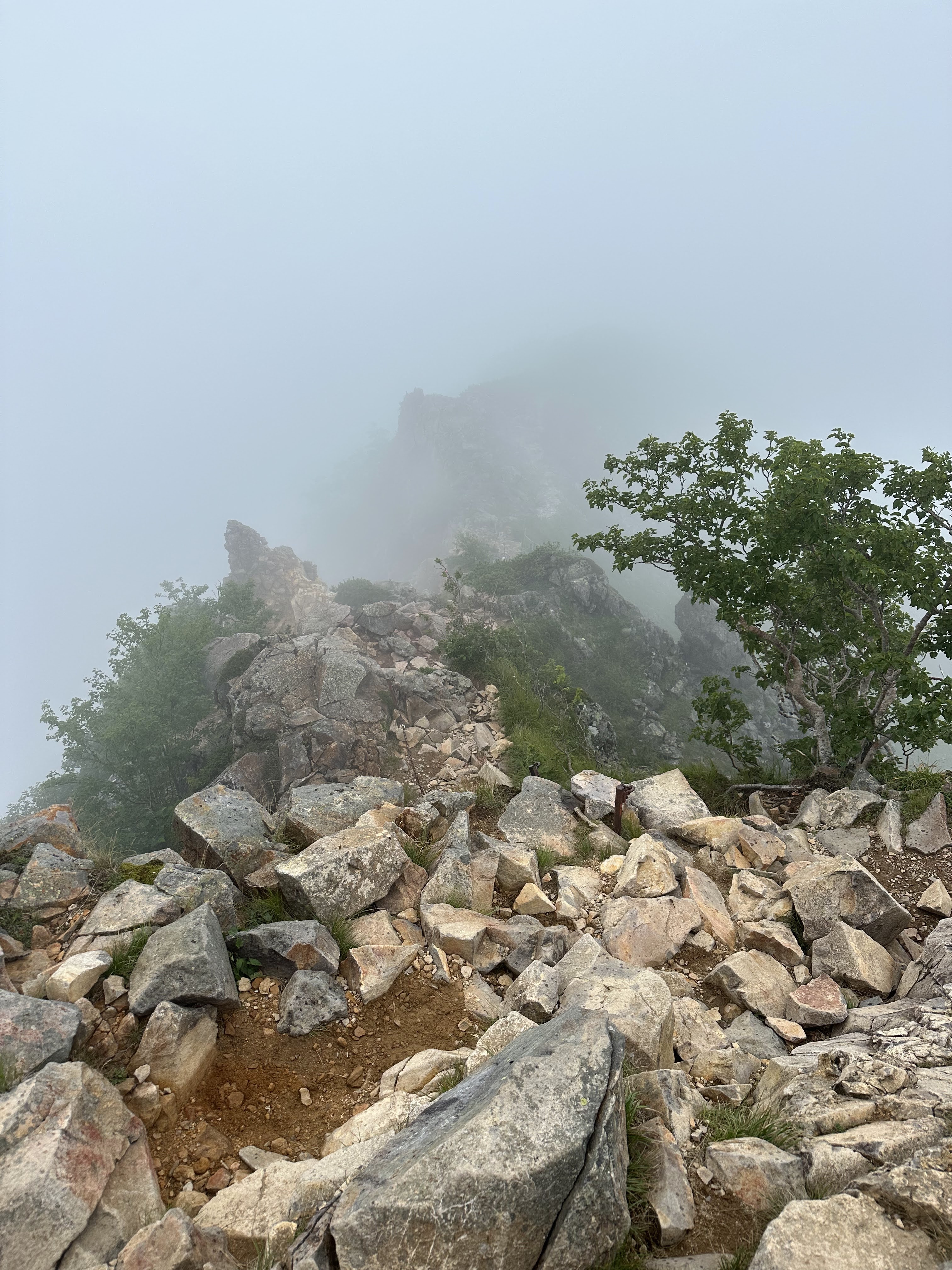
Small moment of clouds clearing up
Continuing on, we look towards Higashi-Tengudake as we continue to make our way through the round trip course. Other hikers along the way had warned us that there was impending thunder 雷/storm so we knew we needed to keep up the pace.


The majority (if not all) of the course is downhill and there are a lot of larger rocks. With the rain, I felt a bit uncertain about where I was stepping and whether it would be slippery, and I was definitely the slowest in the group for this portion. Thunder was rumbling in the distance and then closer and closer as we kept moving.


Last branch point - we're almost back after crossing this bridge!


What went wrong/negatives:
- Google maps didn't take us to the parking for the Sakuradaira trailhead where we were meant to start the Iodake hike. We followed the navigation precisely but didn't realize that despite the pin placement and no indication it was taking you elsewhere, it just considers the end result successful at Karasawa Kosen?? So we did an entirely different hike than I had prepared for.
- Only planned to actually do the hike if the weather was good (no rain). It rained with thunderstorms.
- Only planned to actually do the hike if there would be a view. There was no view.
- Not part of the hike itself, but there were multiple car accidents on the way home, and it took us an extra 70+ minutes beyond the original 3 hours in nearly standstill traffic to get back wtf.
What went "right"/positives:
- Despite 0% overlap with our anticipated route, the overall hike was a similar distance and difficulty.
- We didn't run out of water! (There were less mountain huts on this route than the planned one.)
- Had umbrellas despite no other weather gear to protect from rain which helped keep us dry.
- Lightning didn't hit us lol.
- Fewer other hikers on the route, so we could freely talk and go at our own pace.
- Fun times with friends 🧀
Months ago, our initial hiking plan was to do a 2 day, 1 night hike including Akadake, Yokodake and Iodake (southern Yatsugatake) with a tent stay, but downsized to a day hike for just Iodake. Day of, that spontaneously turned into a day hike for Tengudake (northern Yatsugatake) simply because of where we parked, but honestly, for all the things that went awry, the end result was positive for me. We had a good time with friends + a little bit of a physical challenge which I appreciated. This is just another (the 4th) of those times we went hiking in Japan and it rained, and actually the 5th time we hiked and there was no view lmao. I guess we can't escape it!

Previous hiking in Japan posts: