
Last year, I learned that summer in Japan is more about just summer (clothing) sales lol. It's a good time for hiking and camping! With that in mind and a free weekend, I planned a short trip of outdoor activities with our group of friends to southern Chiba.
Day 1 - hike to the summit of Mt Nokogiri (鋸山) via Shariki-michi course 車力道コース and then through the depleted quarries, "View of Hell" (Jigoku nozoki 地獄のぞき) and Nihonji Temple with the largest sitting buddha and down via Kanto fureai trail (関東ふれあいの道) which is the #3 Climber's trail here.Day 2 - Minamiboso 1-day bike tour by Boso Adventure out of Heguri Hub. A (customizable) 50km bike route through farmland to the beach, a gallery, a couple of road stations and including a stop for a seafood lunch led by Setogawa-san.
Early Saturday morning, we started by catching the Tokyo Wan Ferry that runs from Kurihama in Yokosuka (on the Kanagawa side) to Kanaya in Futtsu (on the Chiba side). The ferry is first come, first served, including cars. Tickets are purchased at the terminal building for 900yen per person 1 way (1600yen round trip) and 4400yen for a standard car, including the driver's fare (7800yen round trip). We wanted to get on the first ferry of the day (leaving at 06:20), so we arrived around 06:00, lined up our car, went to buy tickets and then got back in the car when it was time to load/board. Staff was readily available to guide and direct us, so it was very easy to just follow their instructions and do what everyone else was doing.


For this parking lot, there was a box where you could deposit coins and it is operated on an honor system (with no change given). The Google Maps landmark has "operating hours" but we arrived well before the 09:00 opening time and didn't have any issues parking there around 07:10.


Admittedly, we did take a wrong fork a little bit after that and accidentally followed the trail to seemingly someone's home, but that was definitely on us, because the road did have a "車力道" sign that we too quickly dismissed without stopping to realize that that was the trail name we were trying to follow. We easily backtracked and got back on course to point B just before 08:00 even with the double back delay.

Throughout the trail, there were these maps that also had information about the area and its history. It's mostly in Japanese, but still very useful. We didn't stop too much at these points because we were extremely paranoid about mountain leeches at this point and thought that if we stood still too long, we'd be easy targets for them.

We arrived at point E about 20 minutes later (08:20) and went in the direction of the Observation deck (towards the summit).


And then this is where the stairs and the elevation gain was a little steeper, so we take more breaks as we ascend. The weather was overcast and cloudy, but it was very humid to this point, so we were a bit tired despite having only hiked for about an hour.


We arrive at F after another 20 minutes (and a few more leech spottings) and decide to go to the summit first (500m farther) before coming back for the Observation deck.

It felt like a weird course to the summit because you would go down a couple sets of stairs and then go back up and then down again lol. Thankfully, there were a lot of signs throughout the trail to reassure us we were, in fact, going in the right direction.


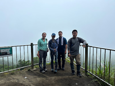
And then the view from the summit (point G) at 09:00 😐. Literally can only see grey, hazy clouds lol.


But we made it to the highest point of Nokogiri regardless! Took us about 1.5 hours from the start of the trail and we spent at least 10 minutes accidentally going on the wrong path and having to double back with plenty of breaks as well. 

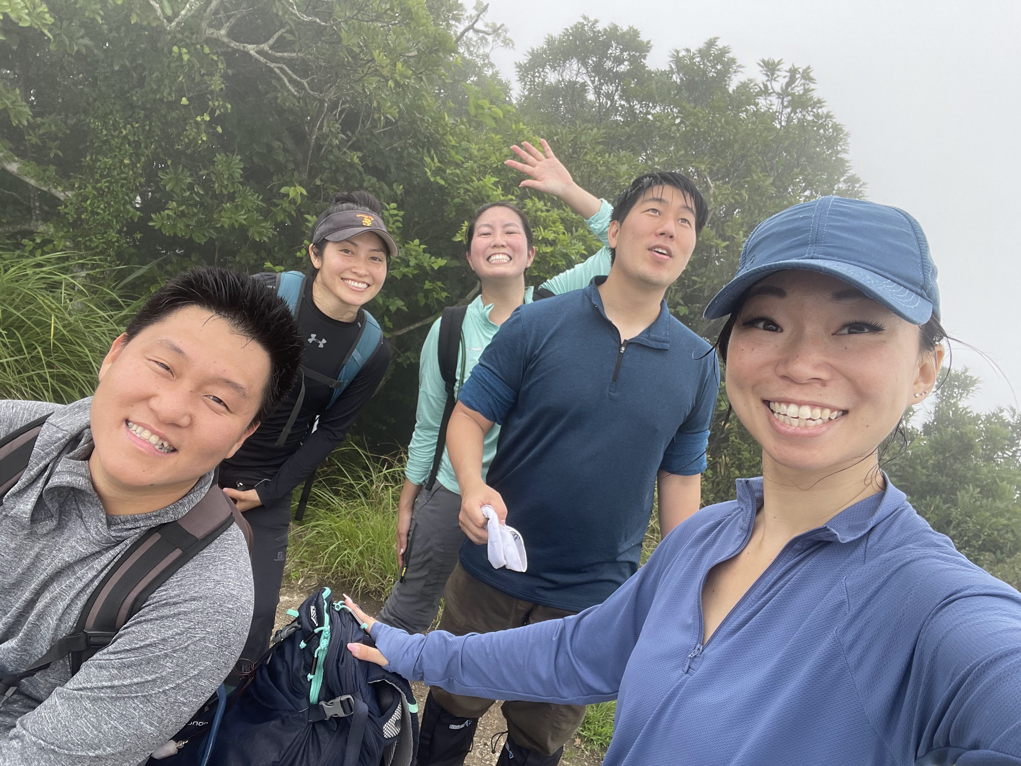
We had largely been hiking alone to this point, but scurried back the way we came with lots of other hikers finally catching up to us to give them their own time at the no-view summit lol.


Back at point F, 20 minutes later, we head up to the observation deck which is just up a set of stairs. This is usually where you can see the "curve of the earth" (proof that the earth isn't flat) but of course we saw....nothing again FML lol. The curved panel showed what you'd typically be able to see on a clear day though.


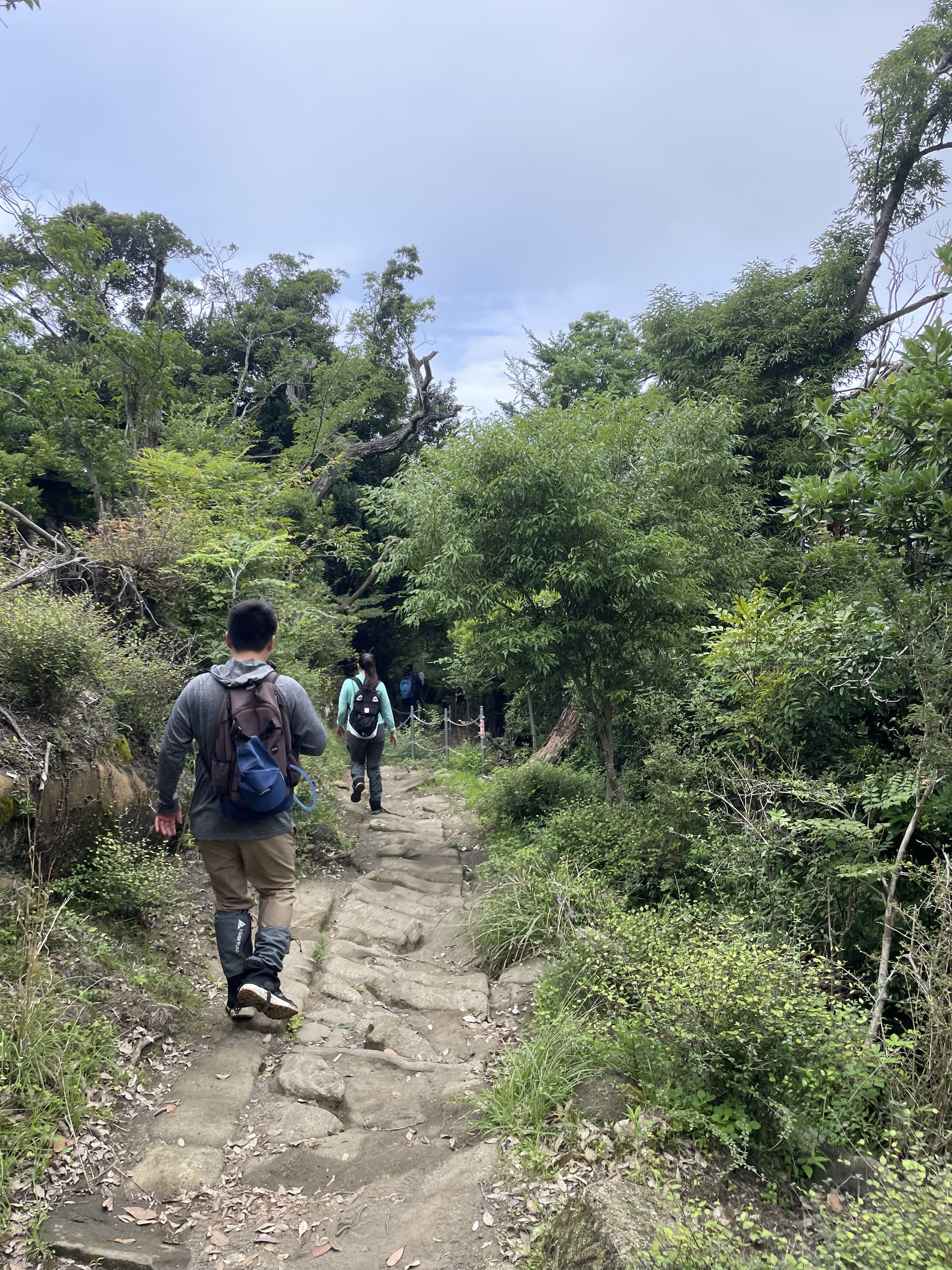
We head back down from the Observation deck and then start on a new route passing the depleted quarries. First is Fukinuke Cave where there is a little pond at the bottom with 1 orange koi fish in it.


Then we pass through Kiridoshi on our way to


Kannon Cave (depleted quarry). It was really interesting to see the square cuts out of what is basically the side of the mountain like that. We didn't spend as much time here as we might have liked because there were groups of other hikers coming to this point from both sides and waiting their turn.


We managed to space ourselves out a bit and had Iwabutai Stone Stage all to ourselves though. There's 3 levels and some old quarry equipment at the site.


Just past point D and C (which apparently I didn't take pictures of), we stopped briefly at the Wall of Laputa where there was another small lookout point where we could almost see the details at the ground level lol.


We got to Nihonji (の本寺) North Management Office at around 10:30, so it took us about an hour to go from the Observation deck at point F to just past point C on the map. Nihonji temple is a paid admission area and the fee is 700yen per adult. This temple can be accessed by car and the Nokogiriyama Ropeway, so you'll see higher traffic of people here and not everyone will be in hiking attire.


Hyakushaku Kannon is waiting for us right after the north entrance.


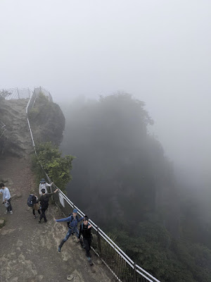
We followed the path and signs through the temple to get to Jigoku nozoki (View of Hell). But, of course, there was no view lol. There is supposedly sometimes an hour+ long wait to get to the end photo spot here on the weekends. But with nothing to look down or out towards, it wasn't very crowded when we were there (although certainly not empty either, with lots of people in regular shoes/street clothes trying to scramble over the bumpy surface).


Nihonji's Daibutsu is supposedly Japan's largest stone carved buddha and quite impressive in person. It's not something we'd typically expect to see at the end of a hike and he's surrounded by nice green scenery.


On our way to get to the Daibutsu, we decided to route through the 1500 Arhat statues (Sengohyaku Rakan). From Jigoku nozoki, there's a lot of descending stairs required to get to the big buddha both directly or through the statue route (which also involves some ascending stairs as well lol).


 There are some shaded picnic-type tables and vending machines available in this area as well as a full bathroom if needed.


It finally cleared up a bit (plus we were at a lower elevation), so we got a little bit of a view out towards Hamakanaya and where the Tokyo Wan Ferry was coming into port.


We walked to get lunch at Hamabe nearby, but there was a line of 5+ people outside. With seemingly not much room inside, and us being pretty hungry after the hike, we decided it wasn't worth the wait. We went to peek at the nearby Pizza Gonzo as well, but apparently that's closed on the weekends lmao.
I had a few other options, but we settled on eating at "The Fish" which has lots of parking and is nearby the ferry stop where J&A would be leaving from after we ate.


Decent seafood options but pricey and not quite what we were expecting from this restaurant. I wouldn't necessarily recommend this place unless you're already in the area and don't want to wait at Hamabe 漁師めし はまべ or Sasuke Shokudo さすけ食堂 (which we passed along the way and had like 30+ people waiting outside wtf). There's a lot of other omiyage shopping in the same venue as well, but definitely better food options if you're willing to venture out and wait more.
Thoughts about hiking Mt Nokogiri
- Total time round trip starting and ending at the car was about 5 hours. We took plenty of breaks as we needed them, weren't rushing and spent at least an hour of that time just in the Nihonji temple area.

- We started the hike at 07:30 and there were plenty of (paid) parking spots of available on the Hanakanaya side of the trail. We hiked on the Shakiri-michi trail pretty much all by ourselves for at least an hour and then only encountered maybe 2 other couples otherwise on our way to the summit. The summit and observation deck (at around 09:00 - 09:30) is when it started to seem crowded with other hikers who must have taken another course to get there or were behind us and catching up.
- I really appreciated that there were constantly signs along the trails on Nokogiri and all walkways on the courses seemed well maintained. I also liked that there was a plethora of information including downloadable maps and course suggestions on the nokogiriyama.jp website!


- There were some steep and angled stairs or slopes, but they were also accompanied by handrails that felt trustworthy. There were also lots of benches throughout the Shakiri-michi course which seemed really thoughtful and gave the impression that you were meant to relax and enjoy being in the area which was nice. We didn't sit on any of them because we were too afraid of leeches, but it was nice that they were available!


- We didn't have big issues with the mountain leeches, but we did take as many precautions as we could with last minute preparations and did see some throughout the trail. If you do this hike during the summer and especially after or during rain, keep an eye out for them and wear full coverage clothing (boots vs hiking sandals, long pants, long sleeve shirt with long socks or pants/leggings tucked into socks). The hike itself isn't extremely challenging, especially with how well maintained the trail is, but you'll want to be covered up. Supposedly they're less of an issue in the colder months. We didn't see (or notice?) any mosquitos, copperheads or masses of bees.
- The "Climber's Trail" we followed has a nice combination of easy-moderate hiking to the summit and then more of an adventure/exploration portion where you check out the quarries and Nihonji temple after which I thought was really cool. If you're looking for something easier or less time consuming and don't mind stairs, I would just stay on the Kanto-fureai trail if you want to get to Jigoku-nozoki/Nihonji.
- Would I do it again? Almost definitely not during the summer and not if the weather is cloudy again. Overcast skies made for a more moderate hiking experience (less hot from the sun) but it was still really humid and the view was non-existent at all the key points. Since the trail well kept and the elevation isn't very high (compared to the Japanese Northern Alps for example), this could definitely be done in the spring or fall with more favorable temperatures and less chance of leeches.
Bonus views of Chiba since we didn't get any on our hike lol -
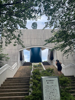
Uomizuka Observatory 魚見塚展望台 on the east side of Chiba's Boso Penninsula (we would have had a view from the west side if it wasn't cloudy on our hike)


The foggy trails and stairs looked really cool! So sad about the lookout points (and the leeches!) though, but your guys' group photos are always so fun to see! I bet the hike is beautiful in the fall. Thanks for another great post! :)
ReplyDeleteThank you for commenting! I really want to consider trying again on a clear (and cooler) day!
Delete