Showing posts with label geography. Show all posts

Thursday, October 1, 2015

Working as a GIS technician

This is part 2 to my "Being a Geography major" blog post and may be a little repetitive to my "What I do for work" Dayre post in some parts but hopefully will also include some new stuff. In this post, I want to focus on the job(s) I've had since graduating that relate specifically to being a Geography major and just some general information about searching for jobs as a Geography major who wants to work in this field. 

Jobs for Geography (geotech) majors
When I was still in school and I would tell people that I was a Geography major, I was inevitably faced with the question, "What are you going to do with that?" I know a lot of college students in general tend to get that question, but I feel like it's especially true for Geography students because most people are unfamiliar with the major. The most common second part to that question is "Oh, so, you're going to teach?" Since most people simply associate geography = memorizing locations, they figure the only thing you can do is become a teacher. But that's really not true at all. It's certainly an option and not a bad one, but I don't think any of the Geography students that I knew (especially in the geotech focus) were intending to become teachers. 
I can't name all the associated geography jobs here (and let me assure you, there are many) but one of the easy tracks for students who focused on GIS is to become a GIS technician and then later a GIS specialist or analyst (with a few years experience under your belt). This is essentially someone who works with GIS as the name implies. GIS techs can work in all sorts of different places and fields - for private companies or federal, state or local governments, big or small. You can even work at Google! Google Earth, maps, streetview, traffic etc. all deal with geography and mapping and constantly need to be updated and reviewed. A lot of non-profit type groups also tend to need GIS help. For example, showing the change over time of a wetland area with aerial imagery to illustrate the need to execute change. These maps can also be used for planning purposes or to track things such as regulatory signs that need to be maintained.
Freelance (or as an employee in a business) cartography is also an option for many Geography majors. Unfortunately, this didn't end up fully coming to fruition, but last year I was asked to help/hired to make maps for a textbook of the Pacific Islands with a friend. There is an existing book, but the maps in it were not created specifically for it and some of them I considered quite awful graphically if I'm honest. Although it didn't pan out, that could have easily been a recurring job if that publishing company every needed maps done for their books and they were happy with our work.
For some reason, a common question people seem to have is "Isn't the world already mapped? Why do we need people who are mappers?". To an extent, yes, I'm sure the world is already mapped. However, that doesn't mean there isn't a need for more mapping. Especially when it comes to updating things and preserving the maps we have from the past and digitizing them on the computer. Not to mention topic-specific maps. Not every GIS analyst/technician/cartographer is making a political map of a piece or part of the world lol. Sometimes you need a map about a very specific topic. How about...idk good dog parks in southern Illinois? idk weird topic and I'm not sure why someone would need that map but I'm sure that map is not readily available on the internet but a GIS tech could probably pretty easily whip one up given the right data! And GIS/mapping definitely comes in handy for planning. Think disaster preparation mapping! Or just a map of a new development. Things like that.
However, small note, just because your major is XXXX in college, doesn't mean that you absolutely must get a job in XXXX field in order to be successful. I know quite a few people who consider themselves to be vocationally successful who are in a job that isn't even remotely related to their college major. My college counselor in high school was a Geology major lol.

Working as a GIS Technician
I have had two jobs working as a GIS technician.  Most people are unfamiliar with what that is so I think the easiest way for me to explain it is to say that I create and edit maps/spatial data. Tbh, the job is a little more than that, but I think that's the easiest way to sum it up in one sentence without getting into the nitty gritty details if the person is only asking to provide polite small talk. I'm actually not comfortable with sharing the specifics of my jobs (on the internet), but hopefully I can still kind of give you all a general idea of what I personally did as a GIS technician.

My first GIS job
As I am writing this, I have only had two GIS jobs so far after graduating. (I don't really count the internship I had during school although technically that was incredibly GIS related as well.) Anyway, my job previous to the most recent one I had was my first GIS job.
I had been working part time as what is essentially an office aid throughout college just to earn money and held on to that job after I graduated. Meanwhile during the last month of school (May), I was constantly on the look out for a job that was related to my major because I definitely wanted to take it if the opportunity arose. My old internship supervisor passed on the word about a job with a few openings, and I called the contact number immediately to find out more information and where to send my resume. In July, I finally heard back that I was being offered a 1-year contract that had the opportunity to be extended. I was a bit nervous to take it because the contract left something to be desired (I highly prefer permanence when I can get it), but I accepted. I didn't exactly know what to expect and actually had a really hard time at this job. Not because I didn't understand GIS, but there was a really difficult coworker who we were forced to work with and nothing could really be done about it.

In any case, here was my desk -
It was nice and huge and I loved it a lot. The building we were in had recently undergone renovations before I arrived, and they didn't have a full office, so no one had been using it before me. We worked with a lot of hard copy maps that were on linen and those maps were a standardized size, so I think when they designed our area, they took the size of the maps that we worked with daily into consideration and that's why I had a lot of desk space. But really, when I finally got the hang of this job, I used all my desk space. Different employers/businesses have different resources but even in school, all the GIS computers had two screens. One screen is usually for the GIS program and the other one is for additional information that is helping you create the map or edit the data so you don't have to constantly minimize and load, etc. I actually had two CPUs and 3 monitors (2 monitors for my GIS computer and 1 monitor for the other which mainly was for data searching that for some reason the GIS computer couldn't handle - don't ask).

Everyday, I did the same process over and over again but just for different geographical areas on the island. And if I had stayed there, I would probably still be doing the same routine everyday until I died lol. When I started, they told us that there was about a 7 year backlog. I'm not really sure how they measured that, but it was essentially because they had hundreds of linen maps that had been edited/drawn/updated by hand (by a drafting technician) that now needed to be converted to GIS. And some maps will take more time than others, but essentially we were redoing pretty much all of the maps and fixing things that needed to be fixed and updating things that had changed while doing that. It wasn't a difficult task, but I would say that the system wasn't the most effective. Since one map's changes could potentially change 5 more and each of those 5 could effect 5 more etc etc, any changes had to be carefully approved by someone in an entirely different department and building. So a lot of our updates got held up there because she's only one person and there was like 6 of us sending her edits. Besides that, there is research involved in doing the changes so it's not necessarily as simple as just looking at it and saying "oh well, that looks fine". In terms of the GIS side of it, there was already an established workflow set up (by an ESRI contractor) so it was really just a matter of pushing buttons down a line. I would say that I don't really think you necessarily needed to go to school for GIS to understand how to do the job. The hard part was really understanding why you were pushing certain buttons and going through the workflow the way it was intended. I know that's a little vague, but I don't want to get into specifics. Let's just say that it wasn't very analysis-based and was really more about editing polygons and placing annotation so the same kind of map over and over again. There were some that were more challenging due to the research that needed to be done or just their general shapes (because each area is different), but for the most part, there was no design involved and you just needed to follow the guidelines to create these maps that should essentially all look the same. Sorry I don't have very many pictures from this job since I really just sat at my desk all day except when we went to Starbucks or something lol (which is obviously not work related).

Putting aside the workplace politics and considering only the GIS aspect, I think this was a pretty good first "real" GIS job for me. I kind of got my feet wet by essentially doing GIS on my own after a brief introduction and for the most part, I was working independently daily. There wasn't an enormous amount of thinking involved, and it was really kind of like intern work (although people of all ages and work experience backgrounds were doing it). I was fresh out of college anyway, so it seemed really acceptable to me. The benefits were pretty good too. I left because I really felt that I was in a hostile work environment that hindered how effective I could be on the daily. It isn't GIS-related so I'm not going to go into detail since I know it's very specific to that workplace, but I really knew I couldn't stay there long term. I'm really happy I took it and it was certainly a learning experience in more ways than one, but I don't think I'd ever go back.

My most recent GIS job
I applied for this job on a whim while I was still at my first job. I was still getting emails from old professors because I was still on my university's geography department's mailing list. I really wasn't super happy at that job, so whenever I got an email about job opportunities, I would always open it, and if it was a simple process, I would apply without expecting anything much. (Like, if I get it, that's cool and if I don't, well, at least I still have a job. I didn't have all my hopes and dreams pinned to getting a new job.) The email about this job wasn't super detailed but the application process was just to send your resume to a certain email address, so I just decided to do it. A week or so later, someone from the hiring company actually contacted me and told me more about the job. It was kind of "spontaneous" but I ended up actually taking the job because it sounded really promising in terms of growth and what we would be doing (which was to be drastically different from I had been doing for the past year with no chance for advancement).

Like the previous job, most of the time, I worked at a desk in front of a computer. My desk was kind of laid out like this.
I worked closely with two other GIS technicians on projects everyday, and we were under the supervision of someone who is an engineer who also has a lot of experience in GIS. We had one main project that we were brought on to help with and sometimes other smaller projects came up that we have to work on as well. (Sorry I know that's not very specific but I don't want to go into too much more detail than that.)

Another part of GIS/Geography that I didn't really hit on earlier is GPS! I mean, this is pretty obviously associated with Geography, identifying where you are on the earth based on feedback from satellites lol. Although most days I sat at a desk, sometimes we needed to do field work! This isn't a part of every single GIS tech's job description (in fact at my first GIS tech job, we never had to leave our desks), but I found a cool part of this job.
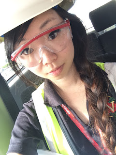
We wore safety equipment most times when going out into the field such as safety vest, hard hat, steel toe boots, long pants and safety glasses. Some venues we visited are more strict about safety than others.
We used a GPS unit (sometimes two) to capture the spatial information using satellites about the topic in question.
For example, if we wanted to make a map of all of the fire hydrants in a facility, we would take the GPS location at each of the fire hydrants we found. I think most people are capable of using a simple GPS these days (and I probably didn't need to get a college degree specifically to use one), but the education comes in when we get back to the office and need to differentially correct and then map the data which sometimes involves further manipulation and analysis. The final product would be a map of the area in question which identified the location of all the fire hydrants. That might pretty boring map most likely but that data can then be used in other situations and could possibly help firefighters if the data was specifically collected for an area that a firehouse services or help identify if there's a need for more fire hydrants...and that was just an example I pulled out of the air, so it's obviously not going to be the best situation since it's not real lol.

Most recently, we had been going on a few site visits and then using our first hand observations, photos and GPS data and creating facility/site maps to be used by the client. We incorporated CAD drawings if they are available as well as as builts and other structural information.

A project that we had just finished when I was first writing this post several months ago was for someone who was going over to help with disaster relief in Kathmandu/Nepal after the earthquake. He used to work in our office but left before I was brought on, and I'm not sure what he does now/who exactly he works for, but he had to suddenly get rerouted from a previous work trip to be sent over to Nepal and needed some maps/imagery because he couldn't generate it himself. We quickly grabbed some recent imagery and created a 140 page mapbook of the Kathmandu area at 1:2500 scale so he could take it out into the field and mark comparisons or changes and things like that.We also created E-size maps of imagery and Nepal as a whole to be put up for display/on a wall for discussion or planning purposes with a group. We had about 6 hours to put it together, so it could be shipped over to him. Meanwhile, there were also other mappers working for the NGS for example who were probably working through the night to give them updated maps, etc to people use in the field! So maps definitely have uses lol.


Unfortunately, I don't feel comfortable sharing any of the particular map products I've created at either job, but hopefully this short glimpse into what I've done in my short time working as a GIS technician might help someone who is wondering about being a geography major/how being a geography major will translate into actually being in the workforce or what practical uses GIS might have. Maybe when I have more experience I'll do an update post, but I have to say that at this moment, I'm pretty happy with my choice of major and that I was happy to be actually working in this field. It's not the #1 most exciting thing ever on a daily basis, but I'm fortunate to be employed at all, much less in my actual field of choice. This isn't even something I knew WAS a job like 5 years ago lol.

I've had this post drafted and practically ready to go literally for months, but I always prioritized working on coordinate/fashion posts and this got pushed back because I figured there was no real rush. However, I have just taken a new job two days ago, and I figure that this transition would be a good excuse to finally publish it. My new job is no longer GIS-related, and it's for a different employer, but I'm hoping switching jobs, even to one not in GIS, will lead to other opportunities that are GIS-related. I already kind of miss it haha. Truthfully, I do think that I made a bit of a gamble leaving my most recent job, but I'm hopeful for the future.

If you have any questions, I'll do my best to answer them!

Friday, March 13, 2015

Being a Geography major

I've already written part something kind of related to this on Dayre, but I thought this topic might be a nice blog post as well where I can really expand on it. I know my blog tends to lean on the fashion side, but really, I kind of think of it as a personal space to write about things that I think might help other people as a resource on the internet based on my personal experience. I don't want to, nor do I ever intend to, come off as an authority on these subjects, but as someone who wondered about this in the past and tried to google for an answer, I just wanted a post on this topic to be out there coming from an individual rather than just college departments or people making jokes.
Anyway, this might be a little boring for those of you who read my blog for fashion content, but a few people on Dayre actually seemed to like this topic, so maybe it might be a little interesting? It has a bit of college talk though. I'll try to include pictures where I can, but fair warning that this post will likely be text heavy since I didn't know I'd be writing a post about this and don't actually have a large variety of photos to go with each topic lol.

My "journey" to becoming a Geography major
I spent my freshman year at a private (expensive) college in California intending to be a graphic design major (after entering undeclared), and after the first semester, I kind of realized it wasn't worth it. After winter break, I decided to apply to the university back at home because I didn't really much care where I got my degree from - just as long as I received it, and so may as well pay in-state tuition right? Lol. I finished up my freshman year at the school in California and then started my 2nd year of college in Hawaii. I decided I no longer wanted to pursue graphic design at this new school, but I already had a few art classes under my belt, and I really wanted to finish my degree in 4 years so initially I thought I would change to Art History just because I had a few specific credits towards that already. During my first semester, I took a lot of general classes needed by this particular college and then decided maybe I wanted to be a Chinese major instead (which wasn't even an option at my first school). However, after I finished the first semester, I decided that probably wasn't the way to go for me after all, and sat down and tried to figure out what the heck I was doing lol. I basically went through the list of majors and clicked on anything that sounded remotely interesting and that allowed me to get my degree without putting in an additional 4 years and essentially starting from scratch. And Geography fit the bill!
[The reason I typed all that out instead of just simply telling you that I randomly picked Geography as my major was that I wanted to show that you don't have to to know what your major is when you first enter college or even know which college is right for you from the start and that you can make a change if you want to! I think a lot of (American) students feel a lot of pressure during their senior year of high school to pick the #1 best option, but hardly anyone knows what the "best option" is. And even if you think you do, your life/situation might change and then what used to be your best choice isn't anymore. I know it's not an option for every single person out there, but don't be afraid to make a change if that's what's right for you. Just because you pick a major freshman year doesn't mean you're absolutely stuck if you find the classes extremely boring or even too hard for you. You're unlikely to do well in school if you're absolutely hating and resenting it. I'm not advocating just giving up (because, of course, you should ask for help from TAs, teachers, advisors if you need it first), but just that you shouldn't feel chained down by one decision you made at 17 or 18 when it can be changed. I bounced around for a bit but I'm so happy I ended up where I did, and I feel like my life would hardly be the same if I had stuck with any of the previous 3 majors I had or made myself stay at the school I attended freshman year.]
Lol, okay so now you know that I only picked Geography as my major because I was lazy and didn't want to pick a major that required a lot of credits to graduate. At my school, to get a BA in Geography, you only need to take 42 specific credits. That's what sold me instantly lol. Well, that and the description did sound interesting to me tbh.

Being a Geography (geotechnical) student
This is based on my experience at my university only. Many other schools have different programs with different emphases and components, but I will only be speaking about my personal experience and the program as it was when I attended UHM. 
When most people think of Geography as a field of study, they think of memorizing countries, states, capitals, physical feature locations and things like that. That is certainly a component of Geography, but definitely not its entirety. Geography is a social science and essentially investigates place. The Geography program/major actually went through a little bit of restructuring while I was there but the major was separated into 3 "streams" - Human, Environmental and Geotechnical.
I'm not in school anymore and I don't feel like thinking too hard about this, so I'm just going to copy and paste the descriptions for each of those from the UHM catalog (<-- click for source) -
"Human geography investigates the cultural, economic, and political processes that shape human experiences on the Earth; the relationship between the environment, society, and culture; and the nature of place in the Asia-Pacific region.
Environmental geography engages in a systematic study of the Earth's physical environment (atmosphere, biosphere, hydrosphere, and lithosphere) and considers the challenges associated with natural resource management and global environmental change.
Geographic technologies include the study of cartography, geographic information systems (GIS), and remote sensing science."
The way I see it, human geography studies the relationship between people and place and is somewhat similar to cultural anthropology to an extent. Environmental geography is kind of the science part where you study how places formed and why. The geotech side is creating maps and using geographical data. I mean, really it's using technology with geography lol.
 
I was a Geography major with a geotech emphasis, so I'm mainly going to be talking about that since I know it best. There are a plethora of classes you can take at any school, but the classes I chose to take were mainly centered around GIS and cartography. GIS stands for geographic information system(s) and essentially it's a computer-based program that allows users to visualize, manage, analyze, manipulate, store and create spatial data. Cartography is creating maps. Obviously GIS and cartography can easily go hand-in-hand, especially in contemporary times. It used to be that the only way to create maps was to draw them my hand. Now, they can easily be created on the computer. (Sometimes not so easily though lol.) One of the most commonly used GIS programs is by ESRI called ArcGIS. There are many different cartography products out there, but one program that you will probably recognize is Adobe Illustrator! Maps can really be made using any graphics program and really if you have the spatial data, you can create maps of anything and everything.
I think one of the reasons I really enjoyed my classes was that I was learning something that was totally new to me. That, of course, also made it quite difficult at times, but I'm a student who enjoys a little bit of a challenge so things don't get too boring. I didn't even know GIS existed before I was a Geography major. And I never really thought about who made or designed maps, but there is certainly a need.


The GIS classes I took mainly dealt with ArcGIS. It's not a free software, but the school provided us with student copies that would expire after a year if we wanted to load the programs onto our own computers. Otherwise, we would have to use the lab computers. Since I was living reasonably close to campus at the time, I opted to use the school computers a lot because my laptop wasn't really meant to handle programs like that lol. Anyway, the GIS classes I took were mostly lab-based with some additional textbook reading. It's really one of those things that you kind of learn by doing though. We would often be trying to follow along with the teacher on our computers while he led the discussion on a projector screen. Once you kind of get the hang of what all the basic functions do, it's not that bad, but it really takes a little bit to get used to it.
There's really a lot of components to GIS and I'm not going to go into the nitty gritty details here because this is already getting boring, but one of my favorite mapping activities/labs from school was suitability mapping. That's basically when you take spatial data and manipulate/interpret it to show suitable areas for a topic based on specific factors. For example, let's say that I want to build a retirement facility but don't know where to start looking for land to purchase. However, I do know that I would ideally like it to be close to at least one hospital and/or fire station, and I also don't want the land to be on a slope. Additionally, I don't want to go through the trouble of the political process that it would require to change the zoning for an area. So, I only want to look at areas that are OK to develop, have a hill slope of less than 15 degrees and are within 5 miles of the nearest hospital. Furthermore, I need at least 5 acres of land. I can use a program like ArcGIS to figure out where there is available land on Oahu based on those factors. I'll probably want to continue to narrow it down with better factors if I was actually looking to build a facility like that, but I think you get the picture. My result would be a map highlighting the suitable areas for my new retirement facility.

Cartography classes really helped me fall in love with Geography, I think. First of all, I had a pretty great teacher. But second, it kind of paired my initial interested in graphic design with Geography! Basically cartography is map design so there somewhat of an "artistic" element to it. You have to pick the right orientation, fonts, sizing, color schemes, position, etc etc. There's actually quite a lot of components that go into a map, and there are definitely some that are better than others in terms of design. I took two semesters of cartography classes. In the first one, we used Adobe Illustrator a lot in conjunction with mapping programs. If you're in an art related field, I'm sure Illustrator is no big deal, but I had personally never used it before, and I really enjoyed it. Looking at all the maps from each member of the class, there were some students in the class who were more scientifically (than artistically) inclined lol.
Here's an example of a map with some bad cartography-related choices (right). Sorry, I don't know where the original files of these maps went, so I only have the hard copies to show you examples from and they were printed on glossy paper as a final draft so they don't photograph well lol wtf. Anyway, this was one of the first maps I made in the class. Poor AND odd color choices imo. It highlighted the difference quite well but I don't think I would ever create a map like this today lol. So many colors going on and Sand Island is a made made area so idk why I thought to make it green of all colors since it's not like it's green there in the least.
This was another map we were asked to make near the beginning (left). I don't mind the font choice but I think I would probably change the inset (bottom right). And make the north arrow and scale bar stand out a liiiiiittle bit less. + Maybe lighten the color of the ocean? I think this just looks cool because the island kind of looks like the profile of a dragon. But of course, that has nothing to do with cartography lol. That's just the natural geography haha.
This was kind of a fun one (right). It's skinny because it's supposed to be a tri-fold pamphlet cover. The assignment was just to showcase Lana'i and make a tourist want to pick up the pamphlet based on our design/map, and we could pick any topic we wanted. After researching what to do on Lana'i, I decided to focus on the island as a wedding location so there are 4 points to show the top wedding locations in Lana'i. I was proud of myself for digitizing the bride and groom and the bow with my limited Illustrator skills having only picked it up a few weeks before lololol.
For this assignment (left) we had to use a program that distorted the world map based on indices and the lines of latitude and longitude and other stuff like that. I think it was called Flex Projector. Anyway, we were supposed to use the features of that program to emphasize or showcase a topic of our choosing. I kind of cheated and separated out Japan in Illustrator, and then made it larger, but I created the overall shape of the world map in the "I" with the program lol. I actually kind of had a hard time with this assignment in terms of coming up with a topic since it was so broad, but when I figured out I should make the map in the shape of a letter, it all kind of came together. The dots on the map are the locations of the factories in Japan where they produce Yebisu. Plus, it kind of looks like a can, right lol? I would possibly change the colors so it's not like peas and carrots but I was semi proud of this. I digitized in the Yebisu lettering and the little guy in the logo as well which was hard for me lol. Don't look too close.
In this class, we even learned how to use Adobe Flash for maps! (Again, probably not a big deal if you're in the graphic/arts field, but very exciting for me because I never thought I would get to learn how to use a program like that as a Geography major!)

One of my favorite classes was Field Mapping. It's not directly related to the work I did in my GIS or cartography classes in terms of main subject matter, but all are kind of intertwined with the final product, of course. This was actually a Saturday course which almost made me not want to take it since it was scheduled for 08:30am to 04:00pm every Saturday, but I heard great things about the course and the teacher, and I could not have made a better decision to take it. It was awesome. I was introduced to so many tools and programs that I probably never would have touched or even thought about if not for this class. We started off with just easy stuff like creating a map based on distance and a compass (for angle) and then vice versa, but then graduated to using a GPS unit to navigate and plot points. We even got to work with alidades! 
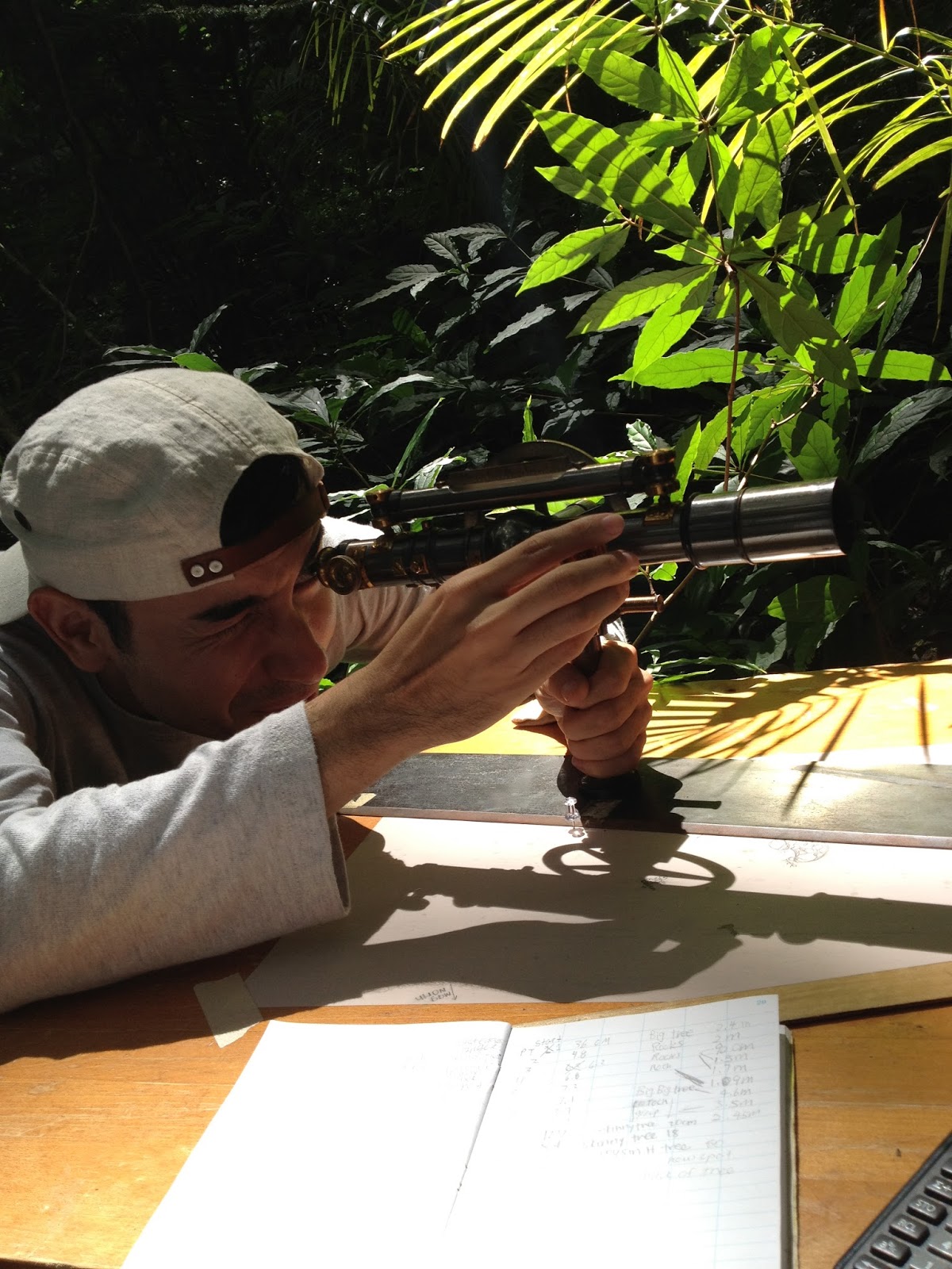
I'm going to be a bit lazy again and not try to paraphrase what an alidade is in my own words and instead just point you to the wikipedia page if you're interested in reading more about it specifically. Personally I had never heard of these before, and was excited to learn to use them since this is a pretty old tool. If I remember correctly, for the ones that we were using (there are more complicated/special ones), we taped a paper to a table and looked through it to see the vertical rod with height measurements where a particular object we wanted to map was located. Based on the angle of the alidade and the number you could see on the height stick, that's where you drew the object on the paper based on a conversion and a ruler measurement. So essentially, for our purposes, this would be used to map where specific things were in an area in relation to each other but not it's exact geographic location in the world. For example, there's a pile rock there and a clump of trees here and there's a ditch way over there and it's XX long, etc.
I don't know if that wasn't a very good explanation but unfortunately I don't think I have any of the maps we made. And the maps we ended up with weren't the best anyway since you end up having to draw in the features like trees and rock formations and stuff where you put the point and the people in my group were not artistic like that lol. But this is a good tool for immediate mapping of important features in a landscape.You can definitely use the map you create with this in conjunction with other tools to create a map with geographical ties (like to a base station) or further illustrate on the computer based on what you've drawn in the field for a stand alone map that's good for hardcopy.
Using the alidade actually involved a lot of calculation between the number that was measured in height (on the stick seen through the alidade) and the number you needed to measure for length on the paper. We worked in 3 person teams for this. One person manned the alidade, one person held the height stick (I know there's a real name for it but it escapes me at this point) and one person takes notes and does calculations. We often had to use a walkie talkie to communicate between the people at the table and the person with the ruler - letting them know if they needed to turn it/hold it straighter/when to move on because we were often at too far of a distance to just constantly shout, especially with other teams working in the same area. This whole course was mostly centered around team work except for a few units, and I was so fortunate to be taking it with two fantastic classmates.

My absolute favorite part of the field mapping class was learning about/how to use total stations! I had never dreamed that I would be able to use something like this. (Not that I really thought about it before but I love learning to use machines like this.) I'm going to be lazy yet again and point you to the total station wikipedia page for the most accurate definition, but basically there are two parts to making it work. One is the total station itself (see below on left) and the prism on a rod (see below on right). The total station collects information based on a signal reflection from the prism. 
Again, this is the kind of tool that would help you map a landscape, but this ALSO collects geographic information (where you are in the world) where the alidade could not (since it doesn't have any electronics on it). There's a lot of components in total stations, but this can basically be a really accurate survey tool, and I'm sure you've seen people in reflective vests using these on the side of the road at some point? They're definitely helpful for planning for construction and things like that.
For certain projects, we would use one total station and several prisms lol (see left). We're trying to accurately show the extent of the grass. So the rods are all lined up along the grass and the person operating the total station will be "shooting" each of the prisms (left to right). When the prism on the left is captured, that guy will move to the right of the line and the person on the total station would just continue to "shoot" prisms down the line until we finished the extent of the grass line. (Hope that makes sense lol.) I don't know if how I explained it sounds really boring, but really I loved doing this! Actually I mostly volunteered to take notes in our 3 person team (1 person operating the total station, 1 person holding the prism, 1 person taking notes) because that was most important to me (to have good notes), but I also liked doing each of the other parts as well and we rotated fairly. Total stations can be sooo wildly accurate and I just love that. I mean, technology!! Come on!! (wtf) After we were done, we usually processed the data in AutoCAD which would show all the point features we took. Then we could further process with other GIS and/or cartography software to get a final map. 

Geography Club
This isn't part of the curriculum (it's a club so it's obviously extra-curricular) but I also wanted to share about the Geography Club at my school! It was kind of defunct in the first years I was in the program, but during my last year, a few of my classmates decided they wanted to revamp it and build it anew. I was someone they asked to be a part of it and was essentially the secretary for the club. We didn't have a lot of members, but enough to make events fun. Some of the activities we did were hiking, whale watching, aerial photography and beach clean ups and things like that. Anything you could relate to geography was a possible activity - which is basically almost anything outdoors lol. Plus there was the occasional geography-related movie night. The hikes were probably the most popular though. One of the Geography graduate students was actually focusing on drones/aerial photography with kites, and he had some equipment he let us use, so on most hikes, we would try to set it up once we got to the top and take a few photos.
For some reason I don't remember which hike this is...
But it's a nice view lol. So first you need to set up the kite and anchor it to something.
Then, if you have the right wind conditions, it'll launch into the sky and then there's some kind of pulley system to get the camera equipment up there as well. The camera shutter and angle can be  controlled by a remote from the "ground". But you definitely have to watch out if the wind dies because then the camera and everything will come crashing down.
Sorry I'm a little rusty on the details and intricacies of exactly how it works lol.

As a club, we also did some kite photography at this fishpond area.
The people who were responsible for the land wanted to get some aerial photos of how the land was changing over time. They got in touch with one of the Geography department teachers (or maybe they already knew him) and he asked us, as the Geography Club, to help out. Using the kite to do photography is fun in general, but it's even more fun when it can be used to help people!
We used a member's Jeep as the anchor this time because the wind could get pretty strong and we didn't really have anything else (like a good tree or something) to use in this open field.
Here's  ^^^ some better pictures to help explain how the camera apparatus is hoisted up after the kite is in the air.
Once the kite and camera are in the air, someone or even several people need to control where the kite is flying so you can actually capture photos of what you want lol. After we had it initially in the air, several people grabbed a hold of the kite strings, we were able to walk with the kite to the area that was the subject of the photographs.
For this particular set up, we can't see what the photos look like as we are taking them, but there are more complicated/better set ups where you can. However, that usually adds a lot of weight to the camera because it requires more battery, so this is a lighter and simpler option. You just might need to take a lot more pictures since you have to guess as to whether or not the pictures will show the area you want lol. The grad student who lent us this equipment actually built it himself! So that's kind of like where Geography can intersect with Engineering imo. And actually there is a bit of crossover with GIS and Engineering in general.

Here's just a few more photos of us learning how to use the kite. I just love some of these photos so I wanted to share them lol. I didn't control the kite much myself, so I stuck to taking photos...of the kite taking photos.
On the left below is a meter to check wind speeds and on the right is a close up of the camera equipment that goes up with the kite. You can see the rudder to help direct it with the wind lol.
Up, up and away!
This is something I know I wouldn't have gotten into if I wasn't a Geography student and another one of those things I just think is so cool lol. I'm glad someone thought to revamp the Geography Club. Honestly, it just sounds like something really lame, especially to non-Geography students, but with the right flyer design and plastering it in enough places, we were actually able to get some students we didn't even know that weren't already part of the Geography department to come out to some of the hiking events despite the name of the club lol.

Sorry I know some of these descriptions (especially pertaining to the Geography Club stuff) were kind of shotty. I wish I had been blogging while I was a student so I could have shared the most accurate and detailed version of these things with you! But now I'm just trying to pull things from memory based on some photos I took and that's not the best lol. But hopefully you still got a little glimpse of what it could be like to be a Geography major!
I think I've already gone into more detail than I initially intended, so I'm going to split this post here. I'll have another upcoming blog post dealing more with the vocational side of Geography in relation to my experience as a geotech-specific Geography major.
Hope there was at least a little info here that you didn't know before (and probably didn't need to) if you actually made it to the bottom of the post! If you have any questions, I'd be happy to try and answer them, but it's been two years since I graduated so tbh I'm a little rusty with some of the intricacies of what I did as a student since I wiped them from my memory lol. I'll do my best though! This doesn't necessary definitively represent the average Geography student's experience in college, but I did have a great time in my program, so I did want to share in case it might be helpful to someone in the future. Geography can be so many things and be used is so many ways. 
And P.S. I am actually really bad at knowing what countries are where or what is the capital of whatever so that's really not an essential part of it imo. (Although of course those are generally good things to know lol.)

Monday, May 26, 2014

Hiking on Oahu

Since I'm grasping at straws for entry ideas, I thought maybe I could write about some things to do in Hawaii. I get this question more than I thought I would on Tumblr.
One great thing to do here is hiking! If you're vacationing, this is not always practical because you have to bring/buy clothes especially for this activity, but if the weather is good and this is the kind of thing you're into, I definitely suggest it!
I'm not super active/physical myself, but you can really go at your own pace for hiking. Yelp is also a great resource for hike suggestions. Just type in the name of one of these (or any that you hear about) and it will tell you the difficulty level (whether it's good for children or pets and things like that) and other reviews from people will come up! 
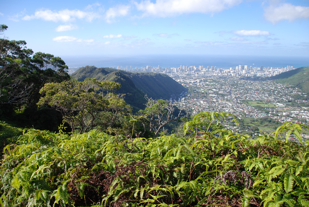
Here are a few photos from hikes that I've been on. Sadly, I rarely get to photograph the whole of the hike because I don't want to put my DSLR at risk! There is often quite a bit of mud or dirt and sometimes even water features that you have to navigate. I'd rather complete the hike with my camera in tact, so I don't keep my camera hanging from my neck the whole time and I can focus on getting my body to do what I need it to do (lol) without worrying about damaging it.
Anyway, hopefully these photos will kind of give you an idea of what a few of these locations are like!

Ka'au Crater

This is about a 6 hour long hike and it's a loop unlike many of the others (where it's one way in and you go the same way back). Definitely don't recommend for beginners or people who don't have hiking shoes!


These were taken at around the half way point.

I took almost zero pictures on the way back because there was so much brush and mud and dirt. My hands were filthy, and I didn't want to handle my camera! I'm glad I did this hike once but I don't think I'm in a rush to do it again.

Makapu'u (Light House Trail) (and Tide pools)


You can go down the rocks (the marker is a whale sign!) to the tide pools. There are spray paint arrows to mark the easiest way to go down but if you're adventurous, I suppose there's no wrong way


Koko Head stairs
 To some people this is not a "real hike", but the views are nice when you get to the top. Basically it's an old wooden rail road track that can now be used as "stairs". There's about 1048 steps total. This one is not very hard (again, if you go at your own pace), but the catch is that it's entirely in the sun and it's usually pretty busy! There's almost no shade anywhere including at the top. The views are worth it though!
 One of my favorite pictures! I love that there's a rainbow in the back.


Wa'ahila Ridge Trail
This is one of my favorite hikes to do (tbh because a lot of it is in the shade). The beginning is super easy and boring (but still has nice views), but if you continue to the "Mt. Olympus" section, it gets really difficult and the views are really really nice.


Sadly, I can't find my pictures from the very very top. Most of the ones pictured here are from the middle and lower section of the hike. Still very nice though.

Diamond Head
Diamond Head is one of the most popular and easiest "hikes" to do - basically just a lot of walking and you probably don't even necessarily need sneakers. I haven't been on the trail in recent memory (it's more of a tourist thing), but I had an internship in the area while I was still in school, and we were able to go on a restricted area of Diamond Head so here's a few pictures from that! (If you're visiting though, you'll get a different view.)
 
 
 I was in my internship clothes including jeans so that can probably tell you how easy this was to walk through.


Wiliwilinui Ridge Trail
 The beginning is a lot like Waahila. Flat and kind of boring but it really picks up later!
 
 That thing sticking up in the middle is basically the end of the hike I think.
 
The weather was really bad the day we went (including rain) so I don't have as many pictures as I would have liked.

I've also been to a few other places - Kuliouou, Mariner's Ridge, Maunawili, Pillboxes and a few others - but I can't find good pictures for them/my photo organization sucks/I didn't take my camera out because it was raining or super dirty when I went! I'm always grateful for the mental pictures and memories I took though because if I wasn't worrying about my camera, I was probably focusing on the hike and staying alive lol.
I think the good thing about most of these hikes is that if you get tired, you can stop and turn back at almost any time so people of all levels can do at least portions of these and still get a decent view. I haven't been hiking in awhile because I've been busy and most of these locations are far from my house, but I hope I can get back out there soon!